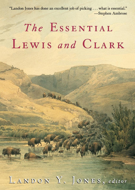
The journals of Lewis and Clark have been called a national treasure. The Corps of Discovery helped to open the Louisiana Purchase to hundreds of thousands of pioneering settlers. We're proud to bring this recreation of those handwritten texts to a new generation of readers, learners, and historians. In 1803, President Thomas Jefferson commissioned the Corps of Discovery as a scientific and military expedition to explore the newly acquired Louisiana Purchase. The expedition's goal was stated by Jefferson in a letter dated June 20, 1803, to Lewis: to explore the Missouri River and such principal stream of it as by its course and communication with the waters of the Pacific Ocean, whether the Columbia, Oregon, Colorado or any other river that may offer the most direct and practicable water communication across this continent for the purpose of commerce .[6] In addition, the expedition was to learn more about the Northwest's natural resources, inhabitants and possibilities for settlement;[7] as well as evaluating the potential interference of British and French Canadian hunters and trappers who were already well established in the area. Jefferson selected U.S. Army Captain Meriwether Lewishis aide and personal friendto lead the Corps of Discovery. Lewis selected William Clark as his partner. Because of bureaucratic delays in the U.S. Army, Clark officially only held the rank of Second Lieutenant at the time, but Lewis concealed this from the men and shared the leadership of the expedition, always referring to Clark as Captain . They began their historic journey on May 14, 1804. They soon met up with Lewis in Saint Charles, Missouri, and the corps followed the Missouri River westward. Soon they passed La Charrette, the last caucasian settlement on the Missouri River. The expedition followed the Missouri through what is now Kansas City, Missouri, and Omaha, Nebraska. On August 20, 1804, the Corps of Discovery suffered its only death when Sergeant Charles Floyd died, apparently from acute appendicitis. He was buried at Floyd's Bluff, in what is now Sioux City, Iowa. During the final week of August, Lewis and Clark had reached the edge of the Great Plains, a place abounding with elk, deer, bison, and beavers. The expedition continued to follow the Missouri to its headwaters and over the Continental Divide at Lemhi Pass via horses. In canoes, they descended the mountains by the Clearwater River, the Snake River, and the Columbia River, past Celilo Falls and past what is now Portland, Oregon. At this point,[clarification needed] Lewis spotted Mount Hood, a mountain known to be very close to the ocean. On a big pine, Clark carved Clark had written in his journal, Ocean in view! O! The Joy! . One journal entry is captioned Cape Disappointment at the Entrance of the Columbia River into the Great South Sea or Pacific Ocean . By that time the expedition faced its second bitter winter during the trip, so the group decided to vote on whether to camp on the north or south side of the Columbia River. The party agreed to camp on the south side of the river (modern Astoria, Oregon), building Fort Clatsop as their winter quarters. While wintering at the fort, the men prepared for the trip home by boiling salt from the ocean, hunting elk and other wildlife, and interacting with the native tribes. The explorers began their journey home on March 23, 1806. Lewis and Clark used four dugout canoes they bought from the Native Americans, plus one that they stole in retaliation for a previous theft. Lewis and Clark separated until they reached the confluence of the Yellowstone and Missouri Rivers on August 11. Clark's team had floated down the rivers in bull boats. Once reunited, the Corps was able to return home quickly via the Missouri River. They reached St. Louis on September 23, 1806.
The Journals of Lewis and Clark
Lewis Meriwether
MSRP:
Was:
Now:
$94.16 - $107.67
(You save
)
- SKU:
- UPC:
- 9781613828441
- Maximum Purchase:
- 3 units
- Binding:
- Hardcover
- Publication Date:
- 2016-09-30
- Author:
- Meriwether Lewis
- Language:
- english

Brand: University of Nebraska Press
The Lewis and Clark Journals (Abridged Edition): An American Epic of Discovery (Lewis & Clark Expedition)
MSRP:
Was:
Now:
$14.62 - $54.86

Journals of Lewis and Clark (National Geographic Adventure Classics)
MSRP:
Was:
Now:
$14.04 - $27.48

Thomas Nelson
Lewis and Clark on the Trail of Discovery: The Journey That Shaped America (Lewis & Clark Expedition)
MSRP:
Was:
Now:
$18.47 - $63.48

Brand: Perfection Learning
The Captain's Dog: My Journey with the Lewis and Clark Tribe (Lewis & Clark Expedition)
MSRP:
Was:
Now:
$32.24 - $38.93

Reuben Gold Thwaites
Atlas Accompanying the Original Journals of the Lewis and Clark Expedition 1804-1806, Volume 8
MSRP:
Was:
Now:
$46.80 - $54.41
!


